
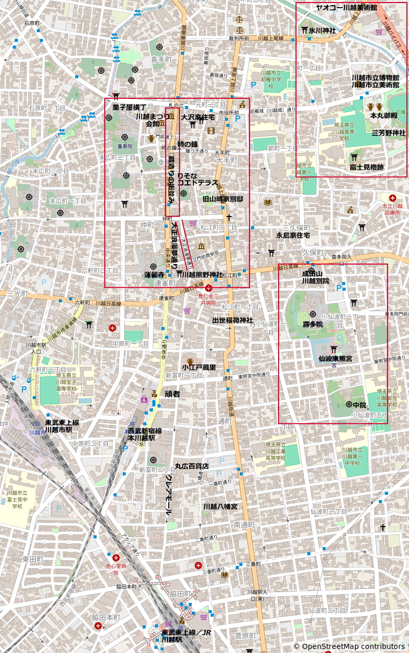
This map is useful for touring Koedo Kawagoe. Because online maps like Google Maps can be difficult to get a bird’s-eye view of the entire area due to their scale, this map was created using OpenStreetMap to provide a clear overview.
As you can see, Koedo Kawagoe’s tourist area is located north of the city center. Therefore, if you’re visiting by train, you’ll need to travel by foot or bus.
The Toki no Kane is approximately 2 km from Kawagoe Station, taking approximately 30 minutes on foot. From Hon-Kawagoe Station, it’s approximately 1.2 km and a 17-minute walk.
Hikawa Shrine is approximately 850m from Toki no Kane and takes about a 12-minute walk. Honmaru Palace is approximately 600m from Hikawa Shrine and takes about an 8-minute walk.
Furthermore, it is approximately 1km from Honmaru Palace to Kitain Temple and takes about a 13-minute walk, but please note that the road is narrow and difficult to follow in some places.
From Kitain Temple to Kawagoe Station is approximately 1.7km and takes about a 25-minute walk, and to Hon-Kawagoe Station it is approximately 1.2km and takes about a 17-minute walk.
We recommend using Google Maps’ route search to check the latest directions before visiting.
If you’re traveling by bus, Tobu Bus and Eagle Bus operate tourist buses.
If you’re coming by car, parking fees are higher in the tourist areas. We particularly recommend using the free tourist parking lots run by the city. Additionally, Maruhiro Department Store’s parking lot offers free parking for up to two hours with purchases of 1,000 yen or more (100 yen for every 30 minutes thereafter).